How GPS Works: Satellites, Atomic Clocks, Trilateration and Relativity
Your phone never talks to a satellite. It just listens to clocks in space and does some very fast math.
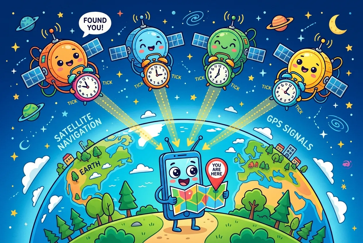
Your phone can find you on a map within a few meters, yet it never sends a single bit to the satellites that make that possible. It just listens. And what it listens for isn't a location at all. It's the time.
This guide explains how GPS works: the satellites and ground stations behind it, why your receiver needs four satellites instead of three, how Einstein's relativity forces a daily 38-microsecond correction, and why a phone that has been off for a week can take a while to find itself.
How GPS works: three segments
The Global Positioning System is run by the United States and is usually described as three parts working together:
- The space segment. Satellites in medium Earth orbit, about 20,200 km up, each circling the planet twice a day. They sit in six evenly spaced orbital planes so that at least four are visible from virtually anywhere. The U.S. commits to keeping at least 24 operational and has typically flown around 31 so coverage survives maintenance and retirements.
- The control segment. A master control station in Colorado, a backup in California, 16 monitoring sites and 11 command-and-control antennas worldwide. Monitors track every satellite; the master station computes precise orbits and clock corrections and uploads them so the satellites can broadcast them.
- The user segment. Every receiver on Earth: phones, cars, aircraft, survey gear and timing equipment. Receivers only listen, which is why GPS can serve unlimited users at once.
Measuring distance with a stopwatch
Each satellite continuously broadcasts two things: when it sent the signal (according to its onboard atomic clock) and where it was, in the form of orbital data called the ephemeris. Your receiver notes when the signal arrives, multiplies the travel time by the speed of light, and gets a distance.
The catch is scale. Light covers roughly 30 cm in a single nanosecond, so timing errors become distance errors very quickly:
C = 299_792_458  # speed of light, m/s

def range_error_m(clock_error_s):
    return C * clock_error_s

print(range_error_m(1e-9))    # 1 ns   -> ~0.3 m
print(range_error_m(10e-9))   # 10 ns  -> ~3 m
print(range_error_m(38e-6)) # 38 us -> ~11,400 mThat is why GPS satellites carry cesium or rubidium atomic clocks. According to GPS World, they are stable to about one part in 1013 over a day, drifting roughly 10 nanoseconds, which works out to about 3 meters of range error between daily uploads. If you're curious how ordinary computers handle time far less precisely, see our explainer on how computers keep time with Unix timestamps and UTC.
Why you need four satellites, not three
In geometry class, three distances are enough to pin down a point in space: each distance defines a sphere around a satellite, and three spheres intersect at your location. This is called trilateration.
The problem is your receiver. A phone can't carry an atomic clock, so its cheap quartz clock is off from GPS time by an unknown amount. Every distance it measures is wrong by the same offset. Engineers call these biased measurements pseudoranges.
The solution is elegant: treat the clock error as one more unknown. Now the receiver solves for four values at once:
- Your position east–west (x)
- Your position north–south (y)
- Your altitude (z)
- Your receiver's clock offset from GPS time
Four unknowns need four equations, so four satellites. A useful side effect: once the receiver solves for its clock offset, it knows GPS time very precisely. Timing receivers with a surveyed, fixed antenna use exactly this to keep equipment synchronized at the 100-nanosecond level.
Einstein's 38-microsecond problem
Here is where GPS becomes a physics experiment that runs every second of every day. Two effects from relativity change how fast the satellite clocks tick compared with clocks on the ground, and they pull in opposite directions.
| Effect | Cause | Change per day |
|---|---|---|
| Special relativity | Satellites move at about 4 km/s, and moving clocks tick slower | About 7 µs slower |
| General relativity | Gravity at orbit is weaker, and clocks in weaker gravity tick faster | About 45 µs faster |
| Net | General relativity wins | About 38 µs faster |
The fix is built into the hardware. The clocks are deliberately tuned before launch to 10.22999999543 MHz, so that once in orbit they tick at the same rate as a 10.23 MHz standard on the ground. GPS World calls this the "factory offset."
Orbits aren't perfectly circular, though. As a satellite swings slightly closer to Earth and speeds up, then drifts out and slows down, its clock wobbles by up to about 45 nanoseconds, or roughly 15 meters of range. Receivers correct for this themselves using each satellite's broadcast orbit data.
Cold starts, almanacs and assisted GPS
Before it can compute anything, a receiver needs orbit data, and satellites send it slowly: the navigation message trickles out at just 50 bits per second. Two kinds of orbit data matter:
- Ephemeris is each satellite's precise orbit. It repeats every 30 seconds and stays valid for up to about four hours.
- The almanac is a rough guide to the whole constellation. It takes 12.5 minutes to transmit in full but stays usable for up to 180 days.
That leads to three kinds of start. A hot start has fresh time, position, almanac and ephemeris, so a fix comes almost immediately. A warm start has a valid almanac and a rough idea of time and position but must download new ephemeris. A cold start knows nothing and has to search the sky from scratch, which on older hardware could take longer than the full 12.5-minute almanac cycle.
Phones dodge most of this with assisted GPS (A-GPS): they download the same orbit data over a fast mobile or Wi-Fi connection instead of waiting for the satellites. Receiver maker u-blox says its online assistance packet is only a few kilobytes, stays valid for two to four hours, and can cut time to first fix to around three seconds.
How accurate is GPS, really?
The government's Standard Positioning Service promises a worst-case range accuracy of 7.8 meters, 95% of the time, for the signal itself. Real receivers usually do much better: FAA data cited on GPS.gov shows high-quality single-frequency receivers achieving horizontal accuracy of about 2.2 meters or better, 95% of the time.
What you actually get depends on factors no satellite can control:
- The ionosphere slows radio signals by varying amounts. Receivers that hear two frequencies can measure and remove that delay, which is why newer civil signals (L2C, L5 and L1C) matter.
- Sky blockage and reflections from buildings, canyons and dense trees reduce the number of usable satellites.
- Receiver quality, from antenna to chipset, varies widely between a budget phone and survey equipment.
Augmentation systems that broadcast correction data can push real-time accuracy to a few centimeters. And the deliberate degradation of civilian GPS, called Selective Availability, was switched off in May 2000; the government says it has no intent to use it again.
GPS isn't the only system in the sky
GPS is one of several global navigation satellite systems (GNSS). Europe runs Galileo, Russia runs GLONASS and China runs BeiDou, all with global coverage. Japan's QZSS and India's NavIC are regional systems that boost coverage over their parts of the world. Most modern phone chips can listen to several of these at once, which gives them more satellites to choose from, especially where tall buildings hide much of the sky.
The receiver chip in your phone is a remarkable piece of hardware. For another look inside everyday devices, see how SSDs store your data with NAND flash.
Key takeaways
- GPS satellites broadcast time and orbit data; receivers only listen and turn signal travel time into distance.
- One nanosecond of timing error equals about 30 cm of range error, so satellites carry atomic clocks.
- Four satellites are needed because the receiver must solve for its own clock error plus three coordinates.
- Relativity makes satellite clocks gain about 38 µs per day; the clocks are tuned before launch to cancel it.
- Assisted GPS downloads orbit data over the network, cutting time to first fix from minutes to seconds.
- Multi-GNSS receivers and dual-frequency signals improve accuracy, especially in cities.
Frequently asked questions
Does GPS need an internet connection?
No. GPS signals come straight from the satellites and work anywhere with a view of the sky. Phones use the internet only for assisted GPS, which speeds up the first fix, and for downloading maps.
Can GPS satellites track my phone?
No. GPS is receive-only: satellites broadcast and your device listens. Any tracking comes from apps or networks that your device sends its computed location to.
Why does GPS work poorly indoors?
GPS signals are very weak by the time they reach the ground, and roofs and walls block or reflect them. Indoors, phones usually lean on Wi-Fi and cell signals to estimate location.
Is military GPS more accurate than civilian GPS?
The signal accuracy itself is the same. Military receivers have historically used two frequencies to correct for the ionosphere, but new civil signals give civilian receivers that same ability.











Comments
No comments yet — be the first to share your thoughts.
Join the discussion