Subtitle: Using an issue‑then‑lift alert cycle to unpack how tsunami detection, modeling, and public warning actually work in 2026—and where Indonesia’s system should invest next.
Why today’s alert arc matters
On days when authorities issue a tsunami warning and later lift it, the entire early‑warning chain is stress‑tested in real time—from the first seismic pings to the last siren’s silence. Rather than repeat unverified minute‑by‑minute claims, this article explains how that “issue‑then‑lift” arc typically unfolds in Indonesia in 2026, what data streams drive decisions, and what the cycle reveals about strengths and gaps. For reference, see the report linked at the end of this article.
An illustrative timeline of an issue‑then‑lift cycle
The precise timestamps vary by event, epicenter, and network health. But a representative sequence in Indonesia’s context looks like this:
- 0–1 minute: Regional and global seismometers detect shaking. Automatic location and magnitude solutions begin to converge. Initial moment tensor and focal‑mechanism estimates flag whether the rupture is likely to be tsunamigenic (e.g., a shallow thrust offshore).
- 2–5 minutes: The modeling pipeline triggers. Rapid source estimates (hypocenter, depth, preliminary magnitude, and finite‑fault proxies) feed tsunami propagation models. If the scenario suggests hazardous coastal amplitudes, the system generates preliminary guidance for forecasters.
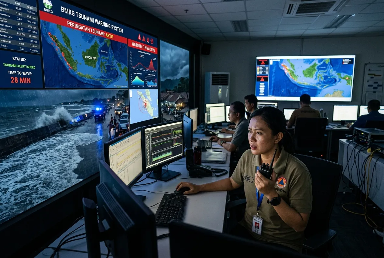
- 5–10 minutes: BMKG duty seismologists and tsunami forecasters review automatic products, cross‑check with regional networks, and prepare an initial bulletin. If thresholds are met, a warning/advisory goes out for exposed coastlines, alongside cell broadcast messages and activation signals to sirens, TV/radio cut‑ins, and official social channels.
- 10–30 minutes: Tide gauges close to the source begin reporting sea‑level perturbations. Where available, DART (Deep‑ocean Assessment and Reporting of Tsunamis) buoys and high‑rate GNSS coastal sensors add ground truth. Forecasters compare observed wave heights and arrival times to model ensembles, adjusting the threat picture.
- 30–90 minutes: As the observation‑model fit tightens, authorities refine zones (some downgraded from “warning” to “advisory”) and update protective actions. If observed amplitudes remain below hazardous thresholds across key gauges and buoys, the bulletin cadence shifts toward cancellation and all‑clear messaging. Local siren networks are silenced once the lift is confirmed.
In short: automation buys speed; human‑in‑the‑loop validation buys confidence. The “lift” typically follows once observations substantively align with a low‑risk envelope from the models.
What feeds the warning: the sensor stack
Indonesia’s tsunami alerts rest on a layered measurement system:
- Seismometers: Dense regional networks and global stations produce rapid solutions for location, magnitude, depth, and mechanism. In 2026, waveform‑based moment estimates and AI‑assisted rupture classifiers help flag tsunamigenic potential earlier than legacy pipelines.
- Tide gauges: Coastal gauges provide the first observed confirmation of anomalous sea‑level fluctuations. Because they sit near shore, they arrive ahead of community reports—but they can be vulnerable to power and telemetry outages during strong shaking.
- DART buoys: These deep‑ocean pressure sensors detect passing tsunami waves before they shoal near land, enabling forecasters to validate and re‑initialize models with real data. Where coverage is sparse, uncertainty windows stay wider for longer.
- High‑rate GNSS and geodesy: Sub‑minute displacement data help constrain rupture size and slip distribution, improving initial condition estimates for the tsunami model suite.
Inside BMKG’s workflows
BMKG’s operations blend automation with expert review:
- Rapid characterization: Multiple, independent magnitude/location solutions arrive within minutes. A shallow offshore thrust with sufficient magnitude can trigger an automatic tsunami modeling run.
- Ensemble modeling: Rather than a single deterministic forecast, BMKG leans on ensembles seeded by plausible source parameters. This yields a range of wave heights and arrival times—critical for risk‑based messaging.
- Data assimilation: As tide‑gauge and DART readings arrive, models are updated, narrowing the envelope of expected impacts. That tightening is what often enables the “lift” decision.
- Multi‑channel bulletins: Bulletins encode zones, severity, expected arrivals, and instructions. They are formatted for both machine reading (to flow into apps and broadcast systems) and human reading (for media and the public).
Speed vs false‑alarm: the core trade‑off
Tsunami decision‑making punishes both delay and over‑warning. Issue too slowly, and near‑source communities lose the precious minutes they need to self‑evacuate. Issue too broadly or conservatively, and repeated false or low‑impact alarms can dull public responsiveness and impose unnecessary economic costs.
Modern practice splits the difference with tiered alerts (warning/advisory/information) and rapid updates as observations come in. The first bulletin optimizes for life safety under uncertainty; subsequent bulletins optimize for precision as data tighten. The lift—when it comes—signals that the observational reality has moved decisively inside a low‑risk band.
How alerts reach coastal communities
The last mile is as technical as the first mile:
- Cell Broadcast (CB): Device‑agnostic messages that light up compatible phones in targeted polygons without needing subscriptions. CB is fast and congest‑proof, but handset compatibility, language clarity, and repeated tests matter.
- Sirens: Coastal siren arrays provide an audible, infrastructure‑light cue—vital when power is out or people are outdoors. Their efficacy depends on maintenance, audibility mapping, battery backups, and local protocols (e.g., distinct tones for “evacuate” vs “all clear”).
- Radio/TV cut‑ins and official apps: These carry richer instructions and maps. In practice, they reinforce CB and sirens rather than replace them.
- Community channels: Mosque loudspeakers, community wardens, and volunteer radio nets often bridge the gap where coverage is spotty.
Gaps revealed—and smart upgrades to fund
Issue‑then‑lift days spotlight where investment moves the needle most:
- Deep‑ocean coverage: Expand and harden DART placement in tsunami source regions that feed Indonesian coastlines, especially along complex arcs where wave behavior is sensitive to source geometry.
- Near‑field geodesy: Scale high‑rate GNSS along subduction margins to constrain slip faster and tighten early model ensembles.
- Gauge resilience: Add redundant power and telemetry to tide gauges, and pair each with a nearby community observer program to reconcile sensor outages with ground truth.
- Model modernizations: Invest in real‑time data assimilation, GPU‑accelerated ensembles, and AI‑assisted source characterization to shave minutes off the first forecast without widening false‑alarm windows.
- Last‑mile redundancy: Maintain sirens rigorously, expand cell broadcast coverage testing across carriers and handsets, and pre‑author multilingual templates for coastal districts with high tourist turnover.
- Public drills and signage: Even perfect tech cannot replace practiced evacuation routes. Regular drills, wayfinding to high ground, and vertical‑evacuation options in flat coastal plains remain essential.
The takeaway
When a warning is issued and later lifted, that is not a failure—it’s the system behaving as designed under uncertainty: act fast to protect life, then refine and step down as reality clarifies. The goal for 2026 and beyond is to shorten the path to precision without sacrificing the protective bias of the first alert. That means better sensors, smarter models, sturdier last‑mile delivery, and sustained investment in public readiness.
Source: Google News RSS article (used here as context; specific timestamps not reproduced).